Travel South Yorkshire - Interactive Public Transport Map - 21/07/2014
Regular patrons of public transport in Sheffield will know that the plethora of buses, trams and walking routes on offer throughout the city can sometimes be a little tricky to co-ordinate. Enter the new online interactive map produced by Travel South Yorkshire. This resource is a great way to view local bus routes, timetables and current running times in the South Yorkshire area, and comes complete with a built-in journey planner. Information about other forms of travel such as trams and trains are also included in this comprehensive guide to getting around. But it's not just for public transport - it also includes many walking routes with places of interest that you can pass en-route, as well as a guide to the types of wildlife and other natural sights to be seen.
The page can be accessed online using this link: http://maps.travelsouthyorkshire.com/
To navigate simply double click on the map to zoom in on an area, or use the + and - buttons on the top right to change the scale from a street-by-street view to a view encompassing the major South Yorkshire area, and every stage in between. Once you have the map set to the right scale you can then move freely around it either by using the arrow buttons on the top right or by clicking and dragging with the mouse.
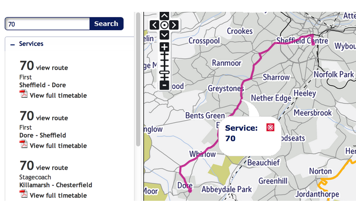
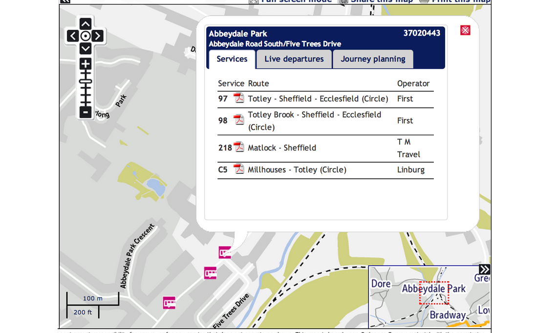
The map is fully updated alongside Ordinance Survey maps, so it can act as a local knowledge base for road names, but the real highlight of this map is that all of the South Yorkshire Travel bus stops are listed down the left-hand side in numerical order. This means more accurate times can be calculated between minor stops that are not always listed on the printed bus timetables, making planning a journey much easier.
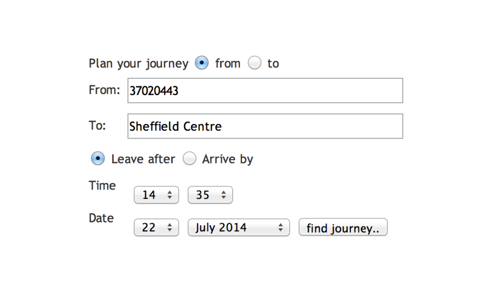
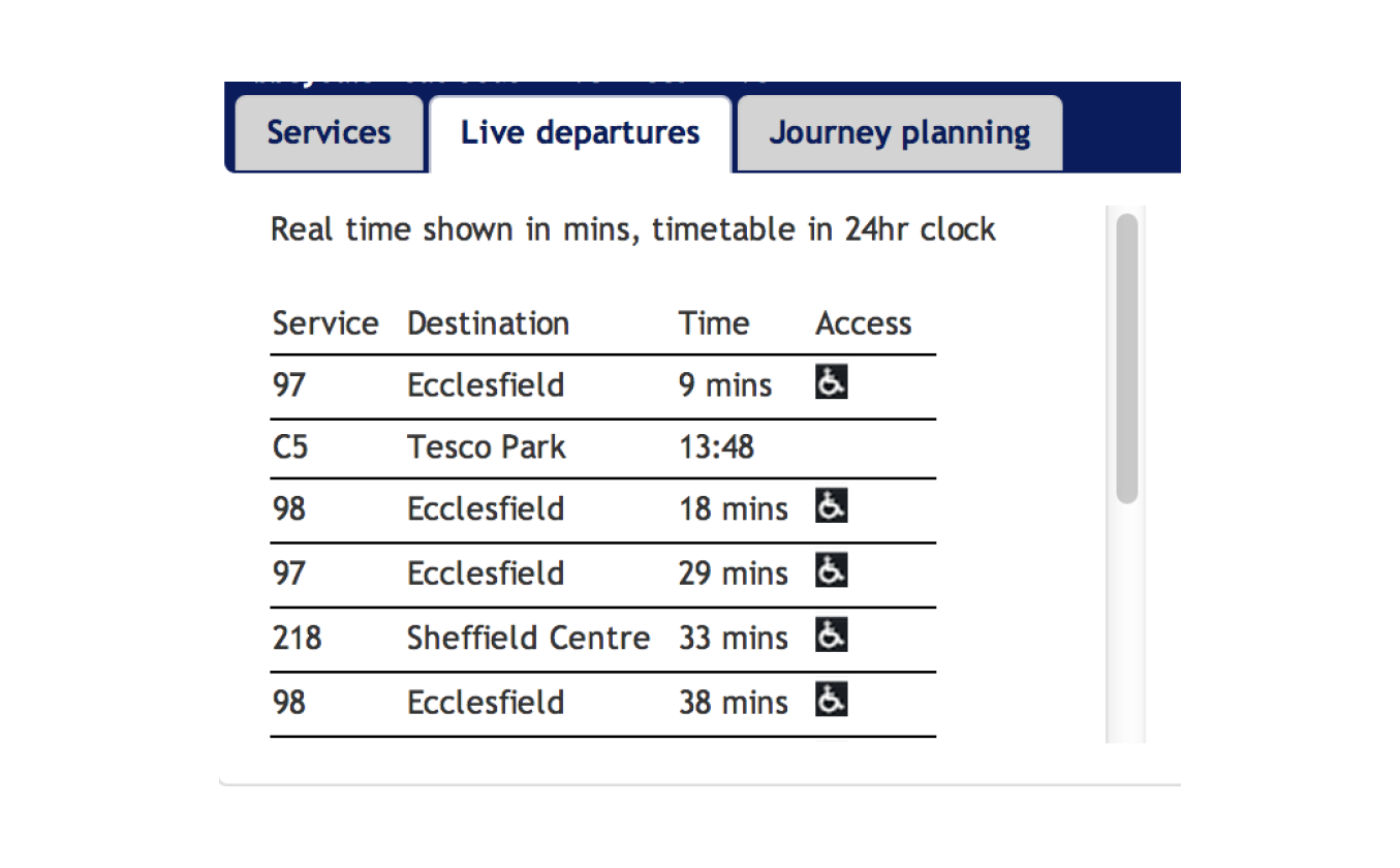
Clicking on a chosen bus route number then automatically moves the user to the location of the first bus stop on the route, and further clicking on the ‘bus’ icon on the map lists a mini-timetable in a pop-up box. This mini-timetable provides information on the bus operators and service numbers of the buses running from that stop, and moving between the tabs shows a live timetable and also a personal journey planner.From this, you can plan your bus journey and find estimates of travel times and routes. The pop-up box also supplies the unique number assigned to that stop, which you can enter into a journey planner to calculate exact stop-to-stop times, allowing a much more precise time estimate than is usually available from the bus timetables. By selecting a route from the right-hand 'Search' section or through the pop-up box, you can also see the route in its entirety displayed on the map, showing a clear, printable route. If you zoom in you can then select any bus stop along the route.
If you need a more extensive range of times for a bus service, the online map also provides links to downloadable versions of the printed bus timetables. While showing only major stops, they provide information on all running times for that service, including weekend changes and operators. These can be found either by using the 'Search' tab on the right or by selecting a certain route on the map itself. This brings up a list of downloadable timetables, accessible through the main South Yorkshire website.
Various other icons are also displayed on the map, including tramlines, hospital locations and school locations, all of which have a journey planner available upon clicking on the icon. For more information, the tab ‘Key’ down the left-hand side describes instructions for downloading the public transport Key map for help with understanding the icons and keys used.
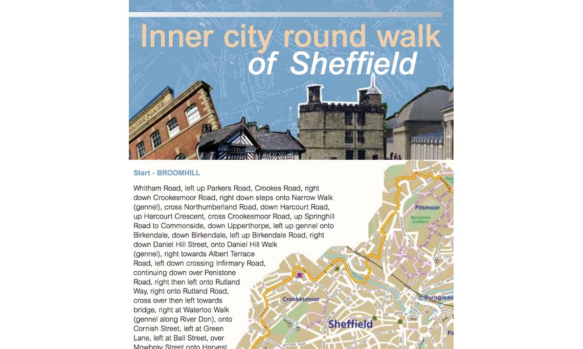
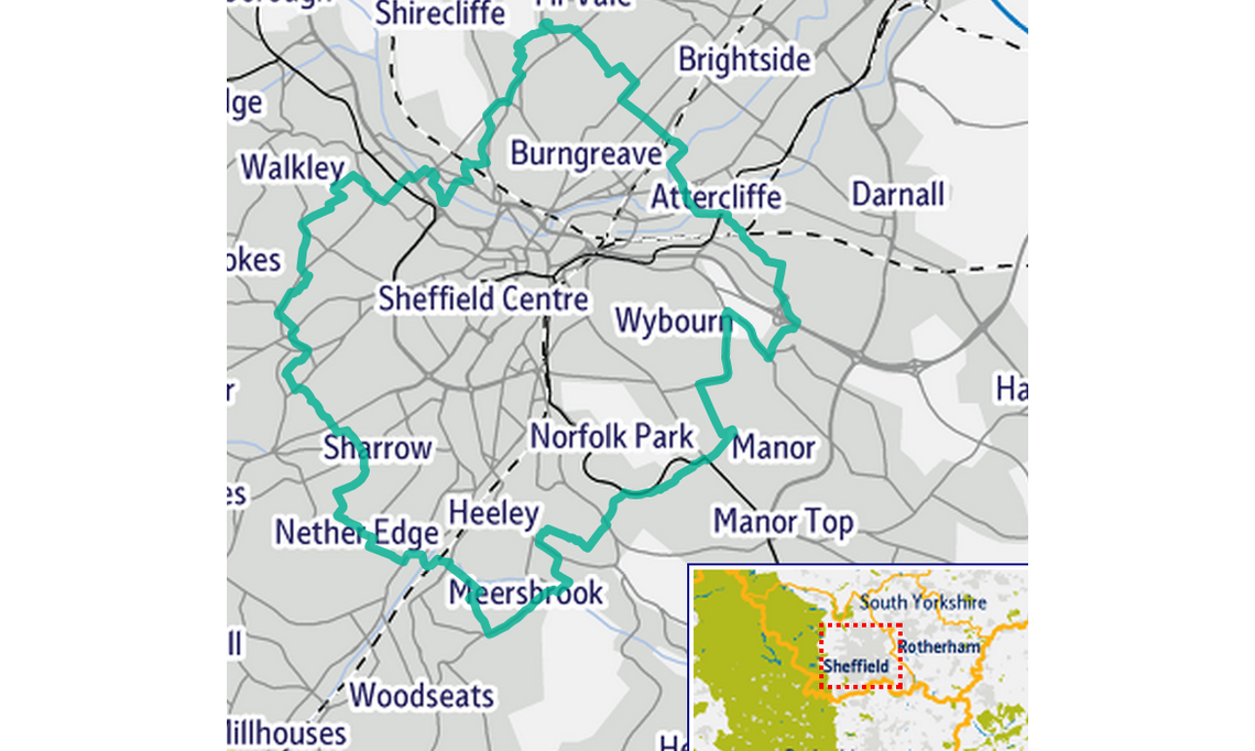
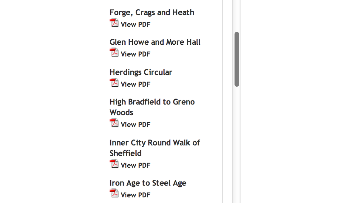
Another useful feature is the Places of Interest search option located within the ‘Walking’ tab. This feature lists walking routes by area in alphabetical order, and includes routes for Barnsley, Rotherham and Doncaster, as well as Sheffield. Scrolling to the bottom of the list allows the user to choose the desired area and clicking on a route brings up a journey planner pop-up box, much like the bus and tram journey plan options.
Viewing the downloadable pdf for each route produces an online information page for that particular walk, and many include the types of wildlife and sites to be seen. This is particularly handy for keen hikers and wildlife watchers, particularly those relying on public transport at the start or end of walks.
Finally, for ease of use, the map can be shared with friends, printed out, and toggled from full screen to half-screen by using the options in the top right-hand corner of the screen. For more information, the ‘help’ tab offers a comprehensive description of all of the features of the map, and also provides a small guide for how best to use it.
Christina Lowe and Claire Shaw